Add Row
Add Element
cropper
update
Drone Central Station
update
Add Element
  • Home
  • Categories
    • Drone Tech
    • Drone Applications
    • Drone Racing
    • Accessories
    • Real Estate
    • Military
    • Disaster
    • Drone Footage
    • Product Reviews
    • Business Profiles
August 05.2025
2 Minutes Read

Rantizo's Transition to American Autonomy: A New Era in Drone Technology

American Autonomy Inc. drone in action spraying crops in a field.

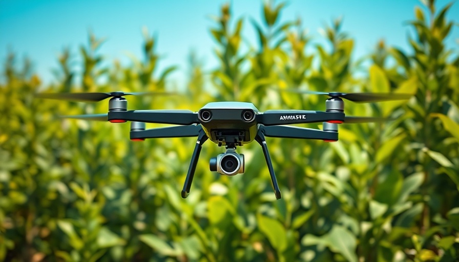
The Shift from Rantizo to American Autonomy: What It Means for the Drone Industry

In a significant strategic maneuver, Rantizo Inc. has announced its transformation into American Autonomy Inc., marking a renewed focus on developing software solutions tailored for the drone spraying sector. This rebranding comes hand-in-hand with the strategic sale of its drone spraying operations, ensuring that the Rantizo name continues to thrive under new ownership dedicated to agricultural technology.

Mariah Scott, previously the CEO of Rantizo, reflects on this evolution, stating, "Our evolution into American Autonomy, Inc. allows us to deepen our focus on software, empowering drone operators with tools to manage their season." This shift not only reinforces American Autonomy's commitment to innovation but also highlights the growing importance of software in enhancing operational efficiency within the agricultural sector.

AcreConnect: A New Foundation for Success

The cornerstone of American Autonomy's software offerings will be AcreConnect, originally developed by Rantizo. AcreConnect is designed to streamline numerous processes for drone operators—from customer management to FAA reporting. This software is crucial as farms increasingly incorporate technology to improve yield, manage resources, and ensure compliance with evolving agricultural regulations.

Understanding the Implications for Agricultural Technology

The acquisition of Rantizo’s operations aims to bolster the American agricultural framework by aligning with industry needs in modern aerial application services. A spokesperson from the acquiring group emphasized their commitment to sustainable growth, stating that the organization will leverage Rantizo's established expertise. This merger aims to create a synergy that benefits farmers through improved access to reliable aerial spraying solutions.

What This Means for Drone Operators and Farmers

For drone operators and farmers, this transition suggests a future where technology not only supports but revolutionizes farming practices. As American Autonomy refines its software capabilities, operators will benefit from enhanced tools that promote productivity and ease of use. This will likely lead to wider adoption of drone technology across various agricultural applications, potentially changing how food is produced and managed.

The Road Ahead: Innovations on the Horizon

With the rise of software-driven solutions like AcreConnect under American Autonomy Inc., we may see further innovations designed to support drone operators. Expectations for these advancements include enhanced real-time data analytics, improved user interfaces, and integration with other agricultural technologies—ultimately fostering a more responsive agricultural landscape ready to meet the challenges of modern farming.

As this transformative period unfolds, it’s evident that American Autonomy is poised to play a pivotal role within the aviation and agriculture technology sectors. The future not only holds promise for American Autonomy and its new offerings but also signals a significant evolution in how farmers and operators can leverage technology to enhance efficiencies and outcomes.

Drone Applications

9 Views

0 Comments

Write A Comment

*
*
Related Posts All Posts
09.25.2025

Understanding the Drone Tsunami Warning System and Its Benefits

Update The Future of Disaster Response: A Technological Revolution In an era where natural disasters pose significant risks across the globe, new technologies are emerging to mitigate their impact. One such innovation is Japan’s BEP Port Disaster Prevention System, developed by Blue Innovation. This system employs drones to enhance the efficiency and effectiveness of disaster response efforts, exemplifying a promising integration of unmanned aerial technology into emergency management. How the BEP System Works: An Overview The BEP Port Disaster Prevention System operates in conjunction with Japan's robust J-Alert emergency broadcast network. When a tsunami warning is issued, drones are automatically deployed from strategically placed drone ports. These drones perform a dual function: they broadcast critical evacuation messages to coastal populations and capture real-time video of disaster-affected areas, providing essential intelligence to emergency responders. This system showcases several key advantages. First, it can disseminate evacuation notices faster than traditional methods. Second, drones can reach areas where human responders might find it dangerous or impossible to go, especially in rural coastal towns where inundation and damage can block access roads. Finally, by automating response deployments, the BEP system reduces the burden on local emergency workers, allowing them to focus on other essential tasks during crises. Applications Beyond Tsunamis: A Versatile Tool for Future Challenges The successful implementation of this drone system paves the way for similar applications in other natural disasters such as earthquakes and typhoons, which frequently impact Japan's coastal regions. In addition to evacuating residents and gathering intelligence, the drones can also assist in delivering first aid supplies, helping to bridge the critical time gap during disasters. While the Technology Is Promising, Challenges Persist Despite the visible advantages, the integration of drones into disaster response is not without challenges. Issues related to regulatory frameworks for airspace, as well as potential technological limitations, must be navigated. In addition, public acceptance of drones operating in emergency situations can vary, which has implications for broader adoption across different regions. Insights from Recent Tests: Real-World Impact The practical implications of the BEP system were laid bare during a recent emergency simulation in Sendai City and Ichinomiya Town. Drones successfully responded to a tornado warning, highlighting their potential to save lives in scenarios where rapid communication is critical. Residents in these areas expressed appreciation for the enhanced safety provided by this innovative technology, indicating that the presence of UAVs in disaster response efforts is a trend likely to gain further traction. Conclusion: Why Embracing Drone Technology Is Critical As Japan continues to confront the realities of frequent natural disasters, the adoption of drone technologies through systems like the BEP Port Disaster Prevention System offers a glimpse into a future where technology plays an indispensable role in safeguarding lives. These innovations not only transform disaster preparedness and response but also set the groundwork for new commercial opportunities in drone applications. Are we ready to embrace the series of advancements that come with it?

09.24.2025

Unlocking Drones' Potential: Why INTERGEO 2025 is a Must for Tech Enthusiasts

Update The Role of Drones at INTERGEO 2025 The upcoming INTERGEO 2025, the world’s largest geospatial event, will take place from October 7–9 in Frankfurt, spotlighting the transformative role of drones and unmanned systems. As countless industries turn to UAV technology for innovative applications, attendees can expect to witness the emergence of drones as vital tools in sectors ranging from environmental monitoring to precision mapping. Exciting Keynote Sessions to Attend On October 7, a dedicated Unmanned Systems program will highlight various UAV applications and technologies. Notable sessions include "Drones, Disasters & Data" presented by Dylan Gorman, which will explore how automation is changing environmental response systems. Andrew House's talk on "Reinventing the Airborne Data Supply Chain" promises insights into making data collection more efficient, while Zhenzhong Su will discuss the game-changing capabilities of AI in the UAV space. Exhibitor Showcases: Innovations on the Horizon The exhibition floor will feature key players in the drone and geospatial technology sectors. Noteworthy exhibitors include: DJI GmbH: Known for their innovative drone technology, they will unveil new tools designed specifically for commercial use in surveying and inspections. Quantum-Systems GmbH: This company specializes in advanced fixed-wing UAVs optimized for endurance and mapping accuracy, showcasing their engineering prowess. YellowScan: Attendees will see cutting-edge LiDAR solutions that integrate seamlessly with UAVs, expanding their usability in environmental applications. These exhibitors highlight the advancements in drone technology that not only enhance geospatial capabilities but also contribute to resilient infrastructure and environmental sustainability. Why You Should Attend INTERGEO 2025 As drones continue to influence essential industries, INTERGEO 2025 will serve as a key platform for networking and discovering the latest advancements in UAV tech. These unmanned systems are integral to future developments in climate adaptation, disaster management, and urban planning. Attendees will gain informative insights and firsthand looks at the tools shaping tomorrow's solutions. Join the movement towards a more automated, efficient, and sustainable future at INTERGEO 2025. Stay informed and engaged with the transformative potential of drones!

09.24.2025

How 5G Drones are Transforming Emergency Response in Germany

Update Revolutionizing Emergency Response with 5G Drones In the critical moments during emergencies, the new 5G drones tested in Germany are changing the game for first responders. The ADELE project, a collaborative effort among Vodafone, Frequentis, and the German Aerospace Center (DLR), showcases how advanced technology can enhance emergency responses. By utilizing Vodafone’s robust 5G network, these drones deliver real-time aerial images directly to control centers, empowering responders and potentially saving lives. Immediate Situational Awareness: Saving Lives with Speed Time is of the essence during emergencies, with the first few minutes often determining the outcome of a situation. The ADELE project's drones can reduce response times drastically from over nine minutes to approximately two, offering vital information before crews arrive on the scene. Michael Reinartz from Vodafone Germany emphasized that "when people’s lives are at stake, every second counts." This shift towards increased speed can indeed be a lifesaver. The Technical Backbone: How it Works The functionality of the drones hinges on a seamless integration between Frequentis’ LifeX and ASGARD control systems and automated drone dispatch. When an emergency call is made, the drone launches and operates beyond visual line of sight (BVLOS), continuously streaming video via the 5G network. This ensures that everyone involved has immediate, consistent information. Günter Graf from Frequentis noted that this shared situational awareness is crucial for facilitating quicker and more effective decisions. Compliance, Safety, and Continuous Improvement Designed to comply with legal standards, the drones feature high-resolution camera sensors and optimized flight paths. DLR project lead Andreas Volkert highlighted how this system not only enhances safety but also adheres to strict data protection laws, including GDPR compliance. To further streamline operations, Vodafone developed the “DroNet Hub” to assist authorities in safely approving flight routes. This meticulous attention to detail suggests that the project is not only innovative but also responsible. Future Trends in Emergency Services The ADELE project marks a significant shift in how emergency services might operate in the future. As Chris von Wrycz Rekowski, the Senator for Finance and Digitalisation in Rostock, stated, integrating automated drone deployment could become standard practice across Germany. Educational and training initiatives could be crucial in aiding responders to adapt to this new technology efficiently. Conclusion: The Call for Technological Integration in Crisis Management The integration of 5G drones in emergency response systems represents a tangible enhancement that could revolutionize how incidents are managed. As trials advance into daily usage, communities must be informed and engaged in these developments. Joining discussions on disaster management strategies highlights the need for continuous technological integration and adaptability in the face of emergencies.

Terms of Service

Privacy Policy

Core Modal Title

Sorry, no results found

You Might Find These Articles Interesting

T
Please Check Your Email
We Will Be Following Up Shortly
*
*
*