Add Row
Add Element
cropper
update
Drone Central Station
update
Add Element
  • Home
  • Categories
    • Drone Tech
    • Drone Applications
    • Drone Racing
    • Accessories
    • Real Estate
    • Military
    • Disaster
    • Drone Footage
    • Product Reviews
    • Business Profiles
August 25.2025
2 Minutes Read

How Urban Drone Connectivity Challenges Are Overcoming Crisis Response Limitations

Advanced drone over urban skyline, showcasing technology amid skyscrapers.

Revolutionizing Emergency Response with Drones

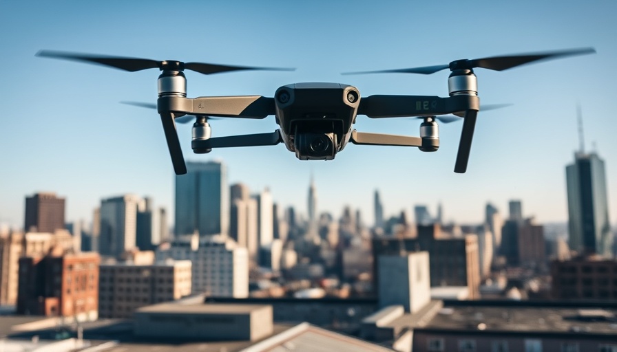
The integration of drones into emergency services through Drone as First Responder (DFR) programs represents a transformative shift in public safety strategies. At the Drone Thought Leadership Summit, conducted by the University of Virginia, experts emphasized the significant operational challenges in urban settings, notably connectivity issues. With towering buildings and dense infrastructure, urban landscapes can inhibit traditional radio frequency (RF) signals essential for drone operations, highlighting a crucial obstacle for first responders in critical situations.

The Importance of Reliable Connectivity

For first responders, maintaining consistent video and control links during missions is vital. Loss of connectivity can severely hamper situational awareness, forcing responders to make decisions without complete information. Not having live video feeds can lead to either over-resourcing an incident or entering a potentially hazardous situation blind. As Ryan Kao of Skydio pointed out, understanding the landscape before reaching the scene can significantly improve outcomes. Thus, addressing connectivity gaps is not merely a technical challenge, but a life-saving necessity.

Innovative Solutions to Connectivity Challenges

Conversely, during the summit, innovative technologies aiming to mitigate connectivity issues were highlighted. One of the standout solutions is Skydio Connect Fusion, a pioneering feature allowing drones to maintain operations by switching seamlessly to 5G or LTE networks when RF connections falter. According to Kao, this functionality is crucial for navigating urban environments, as it empowers drones to continue their mission autonomously without losing critical data streams.

Implications for Public Safety Agencies

The implications of such technological advances are profound. Agencies equipped with drones capable of enduring connectivity interruptions can achieve heightened situational awareness and operational efficiency. This means potentially fewer personnel on scene while still ensuring effective responses to emergencies. With reliable connectivity, public safety agencies not only streamline their operations but also enhance safety for both responders and the public.

The Road Ahead for Drone Programs

As agencies explore integrating drones into regular operations, overcoming connectivity challenges will be paramount. Bridging RF and cellular networks isn't just a technical upgrade; it's key to scaling DFR initiatives and embedding drones in daily public safety workflows. The dialogue around these challenges underscores a critical trend towards the adaptation of advanced technology in enhancing community resilience and emergency responsiveness.

Actionable Insights for Engaging with Drone Technology

For industry professionals and tech enthusiasts, understanding the nuances of drone connectivity can spell the difference between deploying a reliable asset or a limited tool in emergencies. Keeping abreast of the latest innovations, like Skydio's advancements, not only aids in harnessing this technology responsibly but also contributes to the broader conversation around integrating drones into public safety strategies.

In conclusion, the ongoing exploration of drone technologies and their applications in urban emergency response offers exciting possibilities. As barriers are dismantled and reliability increases, we will likely see greater acceptance and utilization of drones in critical response scenarios, solidifying their role as indispensable tools for public safety.

Drone Applications

7 Views

0 Comments

Write A Comment

*
*
Related Posts All Posts
09.25.2025

Understanding the Drone Tsunami Warning System and Its Benefits

Update The Future of Disaster Response: A Technological Revolution In an era where natural disasters pose significant risks across the globe, new technologies are emerging to mitigate their impact. One such innovation is Japan’s BEP Port Disaster Prevention System, developed by Blue Innovation. This system employs drones to enhance the efficiency and effectiveness of disaster response efforts, exemplifying a promising integration of unmanned aerial technology into emergency management. How the BEP System Works: An Overview The BEP Port Disaster Prevention System operates in conjunction with Japan's robust J-Alert emergency broadcast network. When a tsunami warning is issued, drones are automatically deployed from strategically placed drone ports. These drones perform a dual function: they broadcast critical evacuation messages to coastal populations and capture real-time video of disaster-affected areas, providing essential intelligence to emergency responders. This system showcases several key advantages. First, it can disseminate evacuation notices faster than traditional methods. Second, drones can reach areas where human responders might find it dangerous or impossible to go, especially in rural coastal towns where inundation and damage can block access roads. Finally, by automating response deployments, the BEP system reduces the burden on local emergency workers, allowing them to focus on other essential tasks during crises. Applications Beyond Tsunamis: A Versatile Tool for Future Challenges The successful implementation of this drone system paves the way for similar applications in other natural disasters such as earthquakes and typhoons, which frequently impact Japan's coastal regions. In addition to evacuating residents and gathering intelligence, the drones can also assist in delivering first aid supplies, helping to bridge the critical time gap during disasters. While the Technology Is Promising, Challenges Persist Despite the visible advantages, the integration of drones into disaster response is not without challenges. Issues related to regulatory frameworks for airspace, as well as potential technological limitations, must be navigated. In addition, public acceptance of drones operating in emergency situations can vary, which has implications for broader adoption across different regions. Insights from Recent Tests: Real-World Impact The practical implications of the BEP system were laid bare during a recent emergency simulation in Sendai City and Ichinomiya Town. Drones successfully responded to a tornado warning, highlighting their potential to save lives in scenarios where rapid communication is critical. Residents in these areas expressed appreciation for the enhanced safety provided by this innovative technology, indicating that the presence of UAVs in disaster response efforts is a trend likely to gain further traction. Conclusion: Why Embracing Drone Technology Is Critical As Japan continues to confront the realities of frequent natural disasters, the adoption of drone technologies through systems like the BEP Port Disaster Prevention System offers a glimpse into a future where technology plays an indispensable role in safeguarding lives. These innovations not only transform disaster preparedness and response but also set the groundwork for new commercial opportunities in drone applications. Are we ready to embrace the series of advancements that come with it?

09.24.2025

Unlocking Drones' Potential: Why INTERGEO 2025 is a Must for Tech Enthusiasts

Update The Role of Drones at INTERGEO 2025 The upcoming INTERGEO 2025, the world’s largest geospatial event, will take place from October 7–9 in Frankfurt, spotlighting the transformative role of drones and unmanned systems. As countless industries turn to UAV technology for innovative applications, attendees can expect to witness the emergence of drones as vital tools in sectors ranging from environmental monitoring to precision mapping. Exciting Keynote Sessions to Attend On October 7, a dedicated Unmanned Systems program will highlight various UAV applications and technologies. Notable sessions include "Drones, Disasters & Data" presented by Dylan Gorman, which will explore how automation is changing environmental response systems. Andrew House's talk on "Reinventing the Airborne Data Supply Chain" promises insights into making data collection more efficient, while Zhenzhong Su will discuss the game-changing capabilities of AI in the UAV space. Exhibitor Showcases: Innovations on the Horizon The exhibition floor will feature key players in the drone and geospatial technology sectors. Noteworthy exhibitors include: DJI GmbH: Known for their innovative drone technology, they will unveil new tools designed specifically for commercial use in surveying and inspections. Quantum-Systems GmbH: This company specializes in advanced fixed-wing UAVs optimized for endurance and mapping accuracy, showcasing their engineering prowess. YellowScan: Attendees will see cutting-edge LiDAR solutions that integrate seamlessly with UAVs, expanding their usability in environmental applications. These exhibitors highlight the advancements in drone technology that not only enhance geospatial capabilities but also contribute to resilient infrastructure and environmental sustainability. Why You Should Attend INTERGEO 2025 As drones continue to influence essential industries, INTERGEO 2025 will serve as a key platform for networking and discovering the latest advancements in UAV tech. These unmanned systems are integral to future developments in climate adaptation, disaster management, and urban planning. Attendees will gain informative insights and firsthand looks at the tools shaping tomorrow's solutions. Join the movement towards a more automated, efficient, and sustainable future at INTERGEO 2025. Stay informed and engaged with the transformative potential of drones!

09.24.2025

How 5G Drones are Transforming Emergency Response in Germany

Update Revolutionizing Emergency Response with 5G Drones In the critical moments during emergencies, the new 5G drones tested in Germany are changing the game for first responders. The ADELE project, a collaborative effort among Vodafone, Frequentis, and the German Aerospace Center (DLR), showcases how advanced technology can enhance emergency responses. By utilizing Vodafone’s robust 5G network, these drones deliver real-time aerial images directly to control centers, empowering responders and potentially saving lives. Immediate Situational Awareness: Saving Lives with Speed Time is of the essence during emergencies, with the first few minutes often determining the outcome of a situation. The ADELE project's drones can reduce response times drastically from over nine minutes to approximately two, offering vital information before crews arrive on the scene. Michael Reinartz from Vodafone Germany emphasized that "when people’s lives are at stake, every second counts." This shift towards increased speed can indeed be a lifesaver. The Technical Backbone: How it Works The functionality of the drones hinges on a seamless integration between Frequentis’ LifeX and ASGARD control systems and automated drone dispatch. When an emergency call is made, the drone launches and operates beyond visual line of sight (BVLOS), continuously streaming video via the 5G network. This ensures that everyone involved has immediate, consistent information. Günter Graf from Frequentis noted that this shared situational awareness is crucial for facilitating quicker and more effective decisions. Compliance, Safety, and Continuous Improvement Designed to comply with legal standards, the drones feature high-resolution camera sensors and optimized flight paths. DLR project lead Andreas Volkert highlighted how this system not only enhances safety but also adheres to strict data protection laws, including GDPR compliance. To further streamline operations, Vodafone developed the “DroNet Hub” to assist authorities in safely approving flight routes. This meticulous attention to detail suggests that the project is not only innovative but also responsible. Future Trends in Emergency Services The ADELE project marks a significant shift in how emergency services might operate in the future. As Chris von Wrycz Rekowski, the Senator for Finance and Digitalisation in Rostock, stated, integrating automated drone deployment could become standard practice across Germany. Educational and training initiatives could be crucial in aiding responders to adapt to this new technology efficiently. Conclusion: The Call for Technological Integration in Crisis Management The integration of 5G drones in emergency response systems represents a tangible enhancement that could revolutionize how incidents are managed. As trials advance into daily usage, communities must be informed and engaged in these developments. Joining discussions on disaster management strategies highlights the need for continuous technological integration and adaptability in the face of emergencies.

Terms of Service

Privacy Policy

Core Modal Title

Sorry, no results found

You Might Find These Articles Interesting

T
Please Check Your Email
We Will Be Following Up Shortly
*
*
*