Add Row
Add Element
cropper
update
Drone Central Station
update
Add Element
  • Home
  • Categories
    • Drone Tech
    • Drone Applications
    • Drone Racing
    • Accessories
    • Real Estate
    • Military
    • Disaster
    • Drone Footage
    • Product Reviews
    • Business Profiles
August 03.2025
2 Minutes Read

Discover Beagle's Cutting-Edge Long-Range Drone Revolutionizing Inspections

Futuristic drone illustrating long-range drone applications.

Introducing Beagle: A Revolution in Long-Range Drone Technology

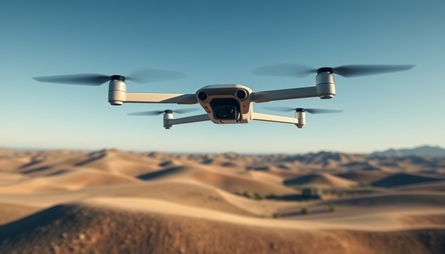
The latest entry into the drone market comes from Hamburg, Germany, where Beagle has unveiled a groundbreaking long-range drone poised to replace traditional inspection methods of energy infrastructure. This innovation marks an important shift in drone application, particularly when inspecting damage after events like natural disasters or conflicts.

Understanding Beagle's Approach and Technology

Co-founded by Oliver Lichtenstein, Beagle utilizes advanced technology to deliver remarkable data accuracy. Their drone, referred to as a "computer with wings," enjoys significant advantages in operational capabilities. Designed to comply with strict EU airspace regulations, the drone is capable of autonomous takeoff, streamlining the workflow for clients.

With a funding boost of €5 million co-led by investors such as AENU and PT1, Beagle aims to heighten its operations beyond the current cash-positive status in Germany. Their service model charges clients per kilometer of pipeline monitored, offering valuable insights for energy companies.

Competitive Edge Over Traditional Methods

While competitors like Intero and Nearmap provide similar services, Beagle asserts its superiority by claiming to have 75 times the resolution of satellite imagery at a fraction of the cost. This efficiency extends not only to the infrastructure inspection sector but could also open new avenues for applications across commercial and military domains.

Diverse Applications and Market Potential

Beagle's drone is not strictly for inspection. Its potential applications could reach into disaster recovery, where accurate situational awareness and hazard detection become paramount. In scenarios where human presence is too dangerous – such as post-war inspections or immediate disaster areas – drones like Beagle's can provide crucial data, ensuring safety while reducing costs associated with helicopter or airplane use.

Future-Proofing the Drone Industry

As drones establish themselves as vital tools in numerous industries, Beagle's commitment to operational excellence and compliance with EU regulations sets a benchmark for other companies. By continuing to innovate and adapt their technology, Beagle not only meets the current market demands but also anticipates future ones, positioning itself as a leader in the drone tech landscape.

The versatility and potential of Beagle's drone extend well beyond energy infrastructure, making it an attractive option for industries ranging from real estate to environmental monitoring. As advancements in drone technology escalate, companies that adopt these innovations will be better equipped for rapid response and thorough analysis.

Conclusion: The Future is Now

As the drone industry evolves, Beagle stands at the forefront of this transformation, using technology to improve safety, efficiency, and data accuracy across various sectors. With its growing capabilities, it opens up a multi-faceted conversation about the future of drone applications. For those interested in tracking how these technologies can influence business and society, staying informed about developments like Beagle's is essential.

To discuss the implications of such technological advancements or to explore more innovative solutions in the drone industry, reach out to local drone experts or join industry forums for more insights.

Drone Applications

0 Views

0 Comments

Write A Comment

*
*
Related Posts All Posts
09.06.2025

Shooting a Drone: The Legal and Personal Fallout You Need to Know

Update Understanding the Legal Consequences of Shooting a Drone Many people are unaware of the severe implications that come with taking a shot at a drone. Recently, a man in a quiet neighborhood grabbed his firearm upon spotting what he thought was a suspicious drone hovering above his property. This unfortunate incident escalated quickly, resulting in his arrest and charges that included felonies and a hefty fine.We came across 'What REALLY Happens if You Shoot a Drone', which covers crucial aspects of drone interaction, and it raised some compelling points that we’re expanding on in this article. Under U.S. federal law, drones are classified as aircraft, and discharging a weapon at any aircraft—regardless of its size or function—is a serious crime. The Federal Aviation Administration (FAA) and federal statute, specifically 18 U.S.C. section 32, come down hard on those who endanger aircraft operations, making it imperative to understand the ramifications and safety protocols involved. Why the Increase in Drone Interactions? As drone technology becomes increasingly common—exemplified by Walmart's delivery drone initiative—instances of public discomfort and misunderstandings are on the rise. When individuals feel their privacy is violated, the knee-jerk reaction can often lead to regrettable decisions. With more drones flying over residential areas, education about drone rights and legal boundaries is more crucial than ever. What Actions Should You Take? If you find a drone hovering over your property, remain calm and do not resort to violence. Instead, consider the following steps: Document the drone's flight: Note the time, location, and any identifying details about the drone and its pilot. Contact local authorities: For immediate threats, utilize the local non-emergency line or your local police department. Know your rights: Familiarize yourself with local laws and regulations about drone flights. By taking these actions, you can address any concerns legally and without immediate confrontation. Best Practices for Drone Pilots For drone operators, making themselves known to the local community can reduce misunderstandings and potential disputes. This might include things like: Wearing a professional vest and using a clearly marked launch pad. Refraining from hovering over private property for long periods. Notifying residents in advance of planned flights in residential areas. Such measures create goodwill and may help prevent hostile interactions, ensuring that flying drones remains a safe and enjoyable activity. Common Misconceptions to Avoid Finally, it’s crucial to debunk some prevalent myths regarding drone ownership and the airspace above your property. Many individuals mistakenly believe: They own the airspace above their property—this is not true; airspace is managed by the FAA. Warning shots or lasers can be legally used to deter drones—introducing any weapon or beam into the airspace greatly increases liability and is illegal. Using a jammer would disrupt drone operation—jamming devices are illegal to use or possess in the U.S. Understanding these facts can help foster a more educated discourse on drone activity and enhance safety for all involved. The serious fallout from impulsively shooting at a drone holds valuable lessons for both the public and drone operators, stemming from incidents like the Walmart delivery drone strike. As drone technology continues to evolve, it becomes essential for communities to stay informed about regulations and best practices. Embracing this knowledge aids in minimizing future conflicts.

09.05.2025

Why the Drone-Powered 'Magic Box' is Revolutionizing Emergency Management

Update Introducing the Magic Box: Transforming Emergency Management In an age where every second counts, especially in emergency situations, the integration of technology can differentiate between life and death. Enter Project CLARKE, a drone-powered initiative from Texas A&M University, affectionately dubbed the "magic box". This innovative system employs artificial intelligence (AI) and machine learning to analyze images captured by drones, rendering a rapid assessment of disaster impact. Think Star Trek-inspired technology, now grounded in reality. How It Works: Within Minutes of a Crisis Imagine a hurricane wreaking havoc, leaving communities in disarray. The need for immediate information is palpable. CLARKE steps in to provide aerial imagery that, through a complex yet efficient AI algorithm, generates detailed maps (orthomosaics) depicting the level of damage sustained. In mere minutes, it can classify the extent of destruction to properties and infrastructures, enabling first responders to prioritize their efforts effectively. The Dual Phase Approach: Responding Effectively to Disasters Texas A&M’s approach is two-fold. The first phase is the immediate response, essential for situational awareness during the crucial first 72 hours following a disaster. Drones deployed in affected areas gather critical data that is relayed to CLARKE. The AI analyzes this data, presenting it in formats that meet the varied needs of different agencies: from spreadsheets to visual overlays indicating specific damage locations. The Real-World Impact of the Magic Box The proven effectiveness of the CLARKE system has been highlighted during the 2024 hurricane season when it was used to assess damages from Hurricanes Debby and Helene across multiple states. Emergency agencies reported significant improvements in their response strategies thanks to timely and accurate information generated by the system. Dr. Robin Murphy, who leads the project, shared insights on their collaboration with Florida UAS 1 and the Pennsylvania Emergency Management Agency, both of which utilized the technology to coordinate efficient responses in rural areas affected by flash floods and severe weather. The Future of Emergency Management Innovations As we enter the peak hurricane season of 2025, the prospects for Project CLARKE remain positive. With about 90 personnel trained across 53 emergency agencies, the reach and implementation of this technology are set to expand further. The potential for utilizing drone technology in various civic applications, from search and rescue to real-time damage assessment in other emergencies, will only enhance public safety and response efforts. This aligns with the broader trend of increasing reliance on drones for diverse applications post-disaster. Conclusions: A Game-Changer in Crisis Situations The advancements demonstrated by the magic box exemplify the marriage of technology with pragmatism in emergency management. As we continue to harness the capabilities of drones, AI, and machine learning, we can anticipate a future where disasters are managed with unprecedented efficiency and speed. To stay informed about advancements in drone technology and their potential applications in your field, subscribe for updates and insights delivered directly to your inbox.

09.05.2025

Mastering Drone Footage: The Importance of Preplanning Your Shoot

Update The Power of Preplanning in Drone Shoots In today's fast-paced tech landscape, the ability to effectively plan a drone shoot can be the difference between a stunning visual masterpiece and a frustrating session. This is particularly significant for drone hobbyists and industry professionals who are seeking to capture breathtaking footage or conduct detailed inspections. Preplanning offers not just a roadmap for the shoot, but also mitigates unforeseen challenges that can arise during filming.In 'Preplanning Shoot', the discussion dives into the essential strategies for planning drone operations, exploring key insights that sparked deeper analysis on our end. Why Preplanning Matters Without a solid plan, drone pilots risk wasting time and resources. Preplanning involves a thorough understanding of the shoot's objectives, site analysis, and weather conditions—all crucial components that can significantly influence the outcome. It ensures that operators know what angles and shots they want to capture, which can help avoid multiple take-offs and landings that can stress both the equipment and the pilot. Tools and Techniques for Success Utilizing flight planning apps is an excellent way to enhance the preplanning process. Many tools available today can provide maps, allow the pilot to set flight paths, and even assess obstacles. These applications can analyze airspace regulations to ensure the drone remains compliant, thereby fostering a safe operating environment. Additionally, favorable weather apps can help predict the best times to shoot from a visibility and wind resistance standpoint. The Emotional Connection to Drone Footage For enthusiasts, capturing drone footage is not just about visuals; it often embodies a passion for creativity and storytelling. When crew members and pilots share a vision through preplanning, they cultivate emotional investment in the project. This connection elevates the quality of the footage and serves to engage viewers on a deeper level. Future Trends in Drone Preplanning As drone technology continues to advance, we can expect that preplanning will evolve as well. Tools powered by artificial intelligence may emerge, allowing drone operators to predict optimal paths and adjusts automatically based on real-time data. Virtual reality could also enhance preplanning by providing immersive experiences, where operators visualize their plans before taking to the skies. Call to Action For anyone involved in drone operations, whether as a hobbyist or a professional, investing time in preplanning can immensely improve the quality of the shoot. Start implementing these strategies and tools today to take your drone footage to new heights!

Terms of Service

Privacy Policy

Core Modal Title

Sorry, no results found

You Might Find These Articles Interesting

T
Please Check Your Email
We Will Be Following Up Shortly
*
*
*