Add Row
Add Element
cropper
update
Drone Central Station
update
Add Element
  • Home
  • Categories
    • Drone Tech
    • Drone Applications
    • Drone Racing
    • Accessories
    • Real Estate
    • Military
    • Disaster
    • Drone Footage
    • Product Reviews
    • Business Profiles
August 03.2025
2 Minutes Read

Bat-Inspired AI Revolutionizes Drone Navigation with Ultrasonic Sight

Futuristic drone with bat-inspired AI over a battlefield scene.

The Next Frontier in Drone Technology

In the ever-evolving landscape of robotics and artificial intelligence, a groundbreaking system has taken flight—a bat-inspired echolocation technology empowered by sophisticated AI. This revolutionary development, backed by the U.S. Army and conducted at the University of Michigan, signals a potential paradigm shift in how machines navigate and recognize surroundings in low-visibility environments.

How Echolocation Works in Nature

Historically, echolocation has been a fascinating aspect of biology, especially noted in bats and dolphins. These remarkable creatures emit high-frequency sounds that bounce off objects, allowing them to construct detailed mental maps of their environment. Researchers have long sought to replicate this natural ability in machines. Traditional sensors have fallen short, struggling with the complexity of real-world acoustic environments. However, this new system emerges as a beacon of hope for industries reliant on precision navigation and object classification.

Innovative Photon-Echo Technology

At the core of this advancement is a synthetic echolocation system that utilizes neural networks to classify objects based not on traditional sensor inputs but rather on simulated ultrasound echoes. This method is akin to how a bat distinguishes between different types of prey based on the subtle differences in the echoes returned to them. The research team crafted an extensive set of virtual environments to generate realistic echo data, circumventing the predicaments that come with gathering real-world training data, which can often be expensive and difficult to obtain.

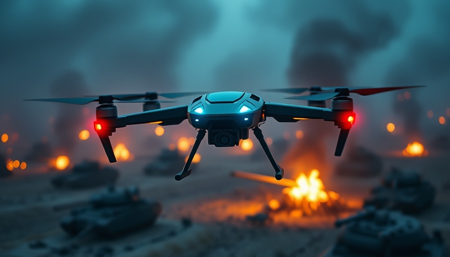
Transforming Military and Commercial Applications

As drone technology matures, the implications for military and commercial aircraft are enormous. The ability to 'see' in complete darkness, through smoke, or amidst clutter gives drones an edge in reconnaissance, search and rescue, and even disaster response. These autonomous vehicles equipped with ultrasonic sight can maneuver in circumstances where traditional optics, LIDAR, and radar fall short. The study published in the Journal of Sound and Vibration not only highlights these capabilities but also serves as a testament to innovations in the fields of AI and robotics.

Promising Accuracy and Adaptability

Results from the research have indicated that the AI can distinguish various shapes with high accuracy, showcasing resilience to the challenges of variable distances, object orientations, and minor manufacturing flaws. For instance, the technology effectively differentiates between spheres and cylinders, which produce remarkably similar acoustic signatures, demonstrating an advanced level of perceptual acuity rarely achieved in artificial systems.

The Future of Autonomous Navigation

As industries seek efficient solutions for navigating complicated terrains, the incorporation of echolocation-like systems in drones is poised to redefine how we approach visibility challenges. This technology not only enhances current drone capabilities but could influence future innovations across sectors, from policing to wildlife conservation. The ability to operate seamlessly in harsh conditions opens a new frontier of possibilities for drones and autonomous vehicles alike.

Drone Tech

0 Views

0 Comments

Write A Comment

*
*
Related Posts All Posts
08.13.2025

The Southeast is Flying High with the First Advanced Air Mobility Corridor

Update Revolutionizing Air Travel: The Southeast's Innovative Corridor The announcement of the first advanced air mobility (AAM) corridor between North Carolina and Georgia signals a transformative shift in how we perceive air travel. Planned to connect Charlotte and Atlanta, this corridor will provide a dedicated air route specifically for electric vertical take-off and landing (eVTOL) aircraft and uncrewed aerial systems. This initiative not only promises to enhance air mobility but also sets a benchmark for future interstate AAM networks across the United States. A Vision for a Sustainable Future Nick Short, director of the N.C. Department of Transportation's Division of Aviation, highlights this corridor as a "launchpad for innovation." By linking two of the Southeast's most populous metropolitan areas, it aims to reduce ground congestion, improve travel efficiency, and foster regional economic growth. Ultimately, the corridor aspires to showcase the benefits of adopting smarter, cleaner, and more sustainable transportation solutions across the region. Technical Insights: Enhanced Safety and Navigation The Charlotte–Atlanta corridor will employ advanced navigation systems and coordinated flight paths to enhance safety for both traditional and next-generation aircraft. This focus on safety ensures that as the technology evolves, it does so without compromising the wellbeing of those on board or on the ground. Additionally, close coordination with South Carolina aims to further integrate regional airspace, paving the way for comprehensive air mobility solutions. Building Collaborations for AAM Deployment This interstate corridor exemplifies a collaborative effort among states, public agencies, and private partners. By fostering communication between various stakeholders, the project anticipates a more effective and quicker deployment of AAM technology. Key goals include not just safety but also ensuring equitable access to transportation opportunities, which could dramatically affect underserved communities. The Economic Impact of AAM As cities grow, their transportation systems must adapt. The advanced air mobility corridor presents countless opportunities for reducing travel times and expanding access to jobs and services. The investment in infrastructure and AAM technology could yield substantial economic benefits, stimulating growth in emerging sectors and attracting tech enthusiasts and drone hobbyists to the region. Conclusion: A Leap into the Future of Transportation As North Carolina and Georgia pave the way for a pioneering air mobility corridor, the implications for urban transport, regional connectivity, and economic development are monumental. This initiative serves as a clear illustration of how technological advancements can reshape our environment for the better. For those interested in the future of transport, keeping abreast of this development and others like it could provide invaluable insights into upcoming changes in our daily lives. Are you ready to embrace the future of air mobility? Stay informed and seize opportunities as they arise in the ever-evolving landscape of transportation technology.

08.13.2025

Explore How AI-Driven Counter Drone Tools Enhance Airspace Security

Update Innovative Solutions in Airspace Security In the rapidly evolving world of drone technology, the advent of DroneShield's SentryCiv addresses critical airspace security concerns for civilian sectors. As drones become increasingly common, the need for robust counter-drone solutions is becoming paramount. Following the escalating threats to public spaces and major infrastructure, SentryCiv emerges as a comprehensive and cost-effective solution tailored specifically for civilian use. Why SentryCiv Stands Out SentryCiv offers an effective shield against potential drone threats while being user-friendly and scalable. Oleg Vornik, CEO of DroneShield, emphasizes the system’s capability to seamlessly integrate into existing security setups, ensuring effective response without hindering operations. This passive, non-emitting technology functions across various environments without disrupting communication networks, making it ideal for places like airports, data centers, and public venues. Understanding the Growing Threat Landscape The demand for tools like SentryCiv is not merely an industry trend; it is a response to the increasing frequency and sophistication of UAV-related incidents. Recent projects, such as the Pentagon's Replicator initiative, underscore the current shift towards advanced counter-drone strategies. As drones continue to be deployed widely, security measures must evolve to protect against their misuse. Without the right defenses, critical infrastructures face unprecedented risks. A Closer Look at Key Features SentryCiv boasts several critical features that enhance its appeal to potential users. The integrated command and control system delivers real-time alerts and priority threat logging, ensuring operators can efficiently manage risks. Its DroneLocator variant offers tracking capabilities for drones and their operators, offering more than just basic detection functionality. Additionally, SentryCiv’s RFAI engine appropriately identifies various common drone models without interfacing with onsite communications, providing absolute assurance of operational continuity in security environments. This tech-savvy solution is also subscription-based, which significantly reduces upfront costs while allowing for continual software enhancements. Staying updated against emerging threats is a key advantage that sets SentryCiv apart in the counter-drone space. Future of Counter-Drone Technology and the Public Sector The continued reliance on drone technology in various civilian applications paves the way for strong counter-drone measures. As experts predict advancements in drone technology, the ability to defend against malicious use becomes increasingly complex. Government initiatives, coupled with advancements in AI, play a crucial role in shaping a future where airspace security remains a primary focus. As industries like aviation, corrections, and utilities face evolving threats, solutions such as SentryCiv provide much-needed security frameworks. Centralizing airspace protection efforts ensures that both military and civilian sectors maintain safety without compromising technological integrity. Call to Action: What Should Stakeholders Consider? As the drone landscape continues to change, companies and entities managing critical infrastructure must recognize the importance of investing in advanced airspace security solutions. Understanding the benefits of platforms like SentryCiv not only enhances safety protocols but also fosters confidence among stakeholders in their operational viability. In conclusion, the emergence of affordable, AI-driven counter-drone tools opens new possibilities for securing airspace in the civilian sector. Make the move towards securing your assets against emerging drone threats today by considering solutions like SentryCiv designed directly with your needs in mind.

08.13.2025

Unveiling the Future of Drone Technology: Zepher Flight Labs' New Facility

Update Zepher Flight Labs Opens New Facility: A Leap for Renewable Drone Tech On August 12, 2025, Zepher Flight Labs (ZFL) celebrated the grand opening of its new facility in Bingen, Washington, marking a pivotal moment for the drone industry and the local economy. As a subsidiary of Heven Drones, an innovative player in hydrogen-powered technology, ZFL is poised to become a prominent regional hub for advanced drone design and production. Fueling Economic Growth through Drone Innovation The region has been experiencing a manufacturing boom, particularly in drone technology. According to reports, between 2015 and 2018, manufacturing added 670 of the net 920 jobs in Klickitat County. With the addition of ZFL’s facility, which is projected to create 20 new jobs by the year's end, the trend towards onshoring drone manufacturing in the U.S. continues to gain momentum. Adam Stolz, CEO of ZFL, highlighted the importance of this new facility by stating, “This new site represents more than a new address—it’s a continuation of ZFL’s remarkable journey and a bold step into the future.” Hydrogen-Powered Future: What It Means for Drones CEO of Heven Drones, Bentzion Levinson, addressed the crowd during the ribbon-cutting ceremony, emphasizing their commitment to harnessing hydrogen-powered technology to redefine drone capabilities. He stated, “Our vision is to redefine what’s possible with hydrogen-powered, runway-independent drones.” This statement underlines the potential benefits of hydrogen technology in addressing operational limitations faced by traditional battery-powered drones. Supporting a Changing Landscape in Defense and Industry Moreover, as the demand for drones in defense increases, companies like ZFL are directly addressing these needs. Levinson added that the new facility in Bingen represents a strategic move toward equipping defense operations with innovative tech solutions that blend endurance with sustainability. Local Impacts and Future Expansion Plans The facility not only serves the immediate technological advancements but also contributes to the community by providing jobs and stimulating the local economy. The impact of ZFL's facility transcends beyond just local job creation; it positions the Columbia River Gorge as a significant player in the drone industry landscape. As the landscape of drone technology continues to evolve, Zepher Flight Labs’ new facility heralds an exciting future for drone enthusiasts and industry professionals alike. The advancements in hydrogen-powered drones may not only improve functionality but could also lead to more sustainable practices in the tech industry.

Terms of Service

Privacy Policy

Core Modal Title

Sorry, no results found

You Might Find These Articles Interesting

T
Please Check Your Email
We Will Be Following Up Shortly
*
*
*